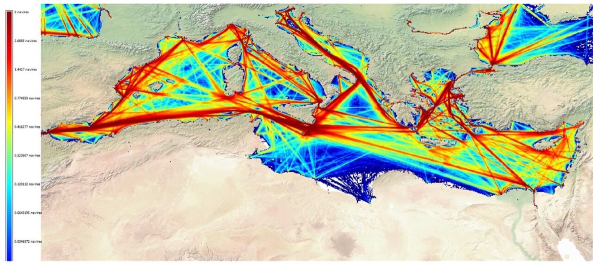
If you open this MarineTraffic link, the map is centered on the coordinates 22.0°N and -80.7°W with zoom 8: a window that covers northern Cuba, the Straits of Florida, the Florida Keys and part of the Bahamas. It is not a random map — it is the corridor through which the oil tankers and bulk carriers that feed (or try to feed) the Cuban electrical grid enter or deviate. After the national blackout on July 7, 2026, thousands of people—on the island, in Miami and in the international media—watch this same area to see if fuel is arriving. This guide explains what MarineTraffic is, how to read the map, what you can and cannot deduce, and why it has become a maritime data journalism tool.
Video: first steps on the Live Map (official MarineTraffic)
Official tutorial: boat search, map layers, filters and zoom at marinetraffic.com. Source: YouTube — MarineTraffic: Getting started with the Live Map
What is MarineTraffic and what is AIS
MarineTraffic is one of the most used platforms in the world to visualize maritime traffic in almost real time. It does not "spy" on ships with secret radar: it adds signals from the Automatic Identification System (AIS), a standard of the International Maritime Organization (IMO) mandatory since 2004 for most merchant ships (SOLAS V/19 regulation).
Each AIS transponder carries GPS and broadcasts data such as:
- MMSI (Marine Unique Identifier)
- Name of vessel, type, flag, dimensions
- Position, course, speed over the ground
- Declared destination and ETA (if entered by the captain)
These signals are captured by other ships, coast stations and satellites (Sat-AIS). MarineTraffic—now branded Kpler AIS since September 2025—processes millions of messages diaries from a network of more than 13,000 receivers in 190 countries and draws them on the web map and mobile apps.

What exactly does your link show (-80.7 / 22.0)
The URL coordinates set the center of the map:
- 22.0°N: latitude of the northern Cuban coast (Havana ~23.1°N; Matanzas ~23.0°N).
- -80.7°W: longitude between the Cuban coast and the Florida Keys.
- Zoom 8: regional scale — you see the entire island to the south, the strait to the north and the Bahamas channel.
In this view, common routes appear:
- Tankers (Tanker) towards Matanzas and the supertanker base next to the Antonio Guiteras power plant.
- General cargo and containers to Havana and the port of Mariel.
- Cruises and ferries (many reduced due to the fuel and tourism crisis).
- Transit traffic between the Gulf of Mexico, the Caribbean and the Atlantic via the Straits of Florida — one of the busiest corridors on the planet.
You can share any view by copying the URL: MarineTraffic saves centerx, centery and zoom in the link, just like Google Maps.
Why everyone is watching Cuba on MarineTraffic in July 2026
On July 7, 2026, Cuba suffered its third national blackout of the year. According to Al Jazeera and Maritime Professional, the Electrical Union managed to reconnect part of the grid, but millions remained without stable service due to lack of fueland obsolete plants (11 of 16 thermal units out of service).
The maritime context:
- Since January 2026, Washington has cut off the flow of oil from Venezuela and threatened with tariffs anyone who sells fuel to Cuba.
- Mexico suspended shipments; imports fell to almost zero in January (PolitiFact).
- Only one large Russian tanker, the Anatoly Kolodkin, received exceptional permission to dock in March 2026 (~730,000 barrels).
- In February, the tanker Nicos I.V. was tracked by MarineTraffic and VesselFinder to Matanzas Bay — the first known delivery after weeks of drought.
- Other ships have turned as they approach (e.g. Ocean Mariner in Paso de los Vientos) when the geopolitical scenario becomes more complicated.
That is why the map is no longer a nautical curiosity: it is a public thermometer of whether the island receives diesel, fuel oil or crude oil to generate electricity.
How to use MarineTraffic step by step (in this area)
- Open the map at marinetraffic.com with a view of Cuba.
- Filters (funnel icon): choose Ship Type → Tanker to see only tankers; also Cargo, Passenger, etc.
- Search vessel: type name or MMSI in the top bar (e.g. “Nicos”, “Anatoly”).
- Click on a ship: side panel with flag, speed, declared destination, photo if available, port history (advanced features require paid account).
- Ports: search for “Havana”, “Matanzas” or “Mariel” to see planned and ongoing arrivals.
- Playback: Replays trajectories from previous hours or days (useful to see if a tanker circled the island or turned off AIS).
- Layers: satellite, nautical chart, traffic density, meteorology (premium part).
Bellingcat guide recommends combining MarineTraffic with VesselFinder, Equasis (official registry), OFAC sanctions lists and satellite photos when investigating It's sensitive.
Who controls the data (and how much does it cost)
| Appearance | Detail |
|---|---|
| Current owner | Kpler (maritime commodities intelligence company); MarineTraffic remains a popular web interface |
| AIS sources | Terrestrial (ports), roaming (relay ships), LEO satellite (<1 min latency on premium streams) |
| Coverage | ~300,000 active vessels/day; coast in more detail than high seas in free plan |
| Free plan | Live map, basic data; destination/ETA/full history → subscription |
| API | Developers and media integrate positions via Kpler AIS API |
| Community | Radio amateurs install homemade AIS receivers to improve coverage in blind areas |
AIS limits: what the map DOES NOT tell you
MarineTraffic is only as good as the signals it receives. The official documentation and researchers warn:
- AIS off (“dark shipping”): a captain can disconnect the transponder to avoid sanctions or piracy; the ship disappears or is only seen intermittently by satellite (why don't I see a ship?).
- False flag and name: registration change, MMSI spoofing; must be contrasted with port records.
- Declared destination ≠ actual destination: the “Destination” field is entered by the crew; It may say "FOR ORDER" or a decoy port.
- Coastal coverage: away from receivers, the position is updated every several minutes or with greater error.
- Small boats: many boats and artisanal fishing vessels do not carry mandatory AIS.
- Delay: “real time” is usually 30 s–5 min; It is not instantaneous military radar.
Seeing an oil tanker stopped off Matanzas on MarineTraffic suggests a port operation; It does not alone prove the volume of crude oil discharged or whether it violates sanctions — that requires customs data, satellite images and diplomatic sources.
Cuban ports that you will see on the screen
| Port | Code | Relevance 2026 |
|---|---|---|
| Havana | CU HAV | Capital; cruise ships, containers, visual impact of blackouts |
| Mariel | — | Special development zone; containers and heavy cargo |
| Matanzas | — | Energy critic: super tankers, Guiteras plant, 2022 fire |
| Cienfuegos / Santiago | — | Southern alternatives; less traffic on zoom 8 north |
MarineTraffic vs other tools
- VesselFinder, FleetMon, ShipAtlas: AIS competitors with similar maps; Sometimes they capture a ship that another lost.
- Windward / Lloyds List Intelligence: risk analysis and sanctions (corporate payment).
- ADS-B (Flightradar24): aerial equivalent; not to be confused with AIS.
- SAR/optical images (Sentinel, Planet): detect vessels with AIS off by their wake or shape.
Legitimate uses and ethical dilemmas
Public AIS has democratized marine tracking: marine families, enthusiasts, journalists and OSINT (open source intelligence) analysts use MarineTraffic to:
- Verify official narratives about aid or fuel arrivals.
- Document blockages, diversions and possible embargo violations.
- Study global trade, illegal fishing or dumping.
It also poses risks: exposing ship routes in conflict zones or facilitating surveillance over vulnerable fleets. U.S. authorities use maritime data combined with satellite and reconnaissance to enforce sanctions — another factor explaining why some captains turn off AIS when approaching Cuba.
Conclusion: public map, real crisis
The link that is circulating — MarineTraffic on 22°N / -80.7°W — is not a toy of little boats on the screen. It is a window to the Florida Straits at a time when Cuba is struggling to maintain lights and hospitals with fuel reserves at their limit. Understanding MarineTraffic is understanding AIS: a mandatory GPS radio in maritime trade, not a magic radar.
For the reader in Miami, Havana or anywhere in the Caribbean: use tanker filters, contrast with verified news from July 7, 2026, remember that an invisible ship may be sailing in "dark mode," and that the island's energy solution does not depend on an icon on a map — but that icon, when it appears in Matanzas, has become one of the few public proofs of immediate relief.
Most read
What readers are engaging with right now.
- Culture
Goose, the gay app that competes with Grindr, reaches the top 4 of Lifestyle in the App Store

- World
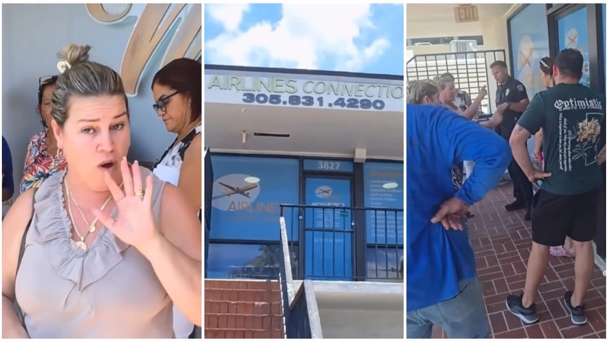
Cubans protest in Miami against Airlines Connections for alleged scam: they demand up to $20,000 in packages to Punta Cana
- World
Trump declares the ceasefire with Iran over, orders new attacks in Hormuz and demands cutting trade with Spain in NATO

- Culture
Harry Potter on HBO: complete guide to the series (not yet released and already renewed for T2), dates, cast and controversies

- Culture
DUK App: Aly Sánchez launches her habits app "one day at a time" with a 63-day program
- Culture
I'm Edgy and Edgy Labs: From Nebraska's Walmart to a beef tallow cream brand that sells across the US.

- Culture
The Evening of the Year VI: all the winners, fights and performances of the Ibai night in Seville

- World
The FBI is investigating the AFA for alleged fraud and money laundering: about $300 million in sponsorships and operations in the US.

- World
El Cangrejo: profile of Raúl Guillermo Rodríguez Castro, Raúl Castro's grandson between GAESA, leaked luxuries and the first interview of 2026