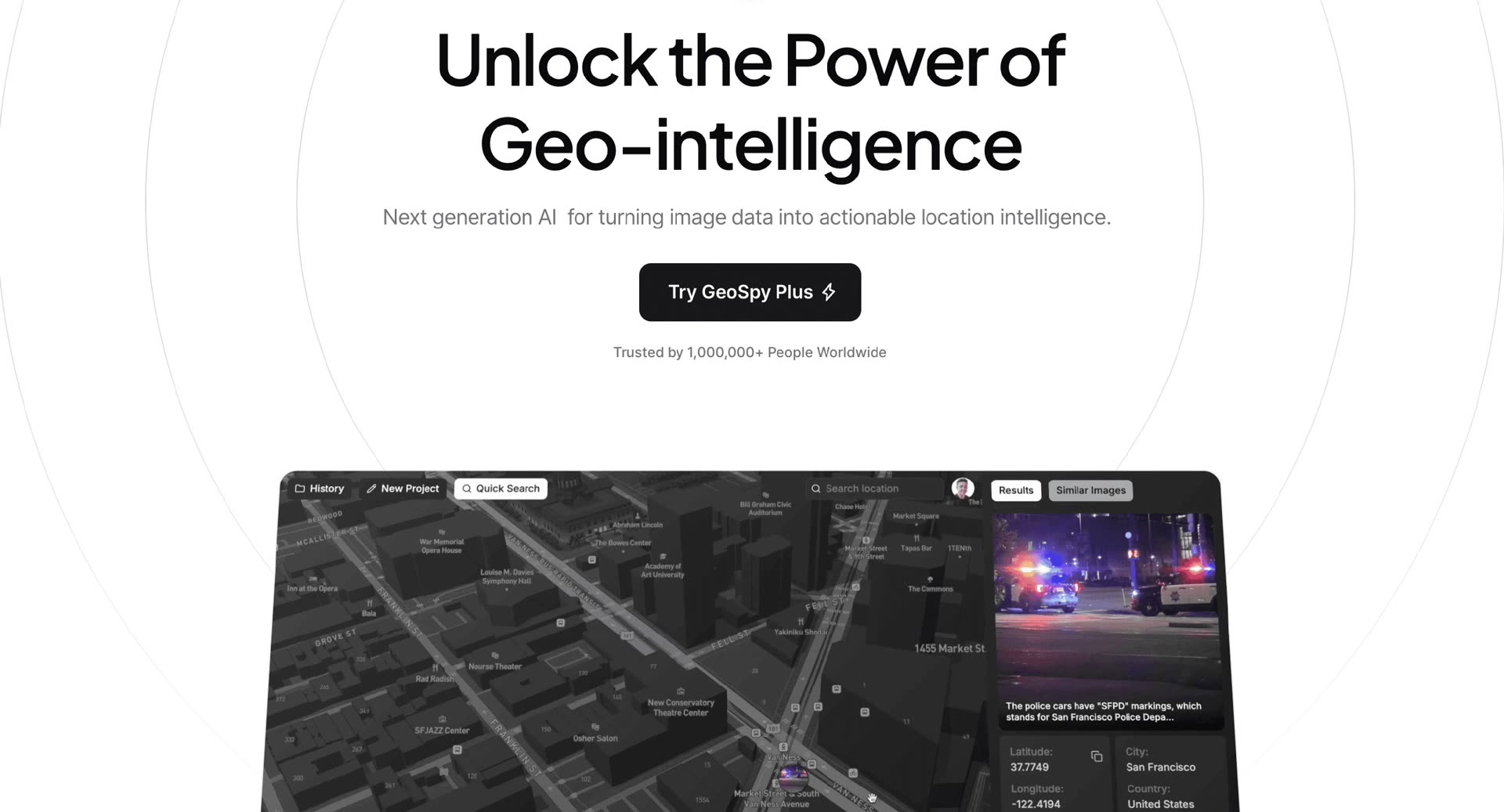
Uploading a photo and knowing where it was taken without looking at the GPS stopped being science fiction when GeoSpy burst onto the OSINT community in late 2023. The Graylark Technologies tool demonstrated that computer vision models can infer regions—and sometimes specific streets—at from vegetation, architecture, sky and soil. After closing public access due to privacy concerns, the company relaunched the technology in May 2026 under the name Raven, with more capabilities and a discourse aimed at investigations and security.
From “pixels to intelligence” to a complete platform
The current geospy.ai website continues to market the GeoSpy brand as “The Visual Intelligence Platform” —turn photos into intelligence. No metadata required—and links to Raven as an evolution of the product. Graylark claims that the platform has helped resolve more than 10,000 cases worldwide, although those figures come from corporate marketing and are not independently audited by MARGENEZ.
According to the release of May 11, 2026 distributed by PR Newswire, Raven integrates in a single interface geoestimation, street targeting with meter precision, vehicle identification and automated scene analysis. Founder Daniel Heinen summarizes the jump: “GeoSpy was just looking for locations; Raven does a lot more. “We want an AI that understands the physical world it sees in an image.”
How geoestimation works without metadata
Unlike classic forensic streams—which rely on EXIF coordinates, file names, or textual clues—GeoSpy and Raven process the visual file as it arrives: blurry snapshots, nighttime CCTV videos, social media selfies, or photos with no apparent context. The models decompose the image into environmental cues (foliage type, soil patterns, architectural style, sky luminosity) and return regional matches with confidence scores.
In demonstrations published by specialized media such as Glitchwire, the flow can refine a broad result to a specific direction by comparing facades with street reference images. A case cited in the technology press: a photo of a broken car window in San Francisco that the system narrowed down to an address on O'Farrell Street with high confidence, without the original publication including geolocation.
«Researchers spend the day looking at images from cell phones, urban cameras and social networks. Raven converts these files into useful information in a few seconds. »
— Daniel Heinen, quoted in PR Newswire (May 11, 2026)
Beyond location: vehicles and deepfakes
Raven adds modules that go beyond the map. CarID attempts to recognize make, model and year from body lines, materials or even partial photos of the interior — useful when only a blurry fragment remains in a security video. Graylark also touts AI-generated face detection and pooling findings from multiple sources into a shared map for research teams.
The company deliberately processes "noisy" material: low-resolution uploads, night footage, and screenshots. That approach fits with the daily work of police units and agencies that do not always receive high-quality evidence.
Who can use GeoSpy and Raven?
Following GeoSpy's initial viralization, Heinen closed open access and refocused the product on governments, law enforcement, and verified enterprise customers. GeoSpy's website indicates that the advanced platform – with location models by city or country and accuracy down to metro level – is available under license to “qualified government and business organizations”, with pricing on request.
Graylark states that large city police departments, international agencies and corporate security teams already use Raven. The geographic coverage exceeds, according to the company, 50 countries. For the average citizen, the implication is indirect but relevant: any image published openly could, in theory, be analyzed by anyone who has access to these tools.
Privacy, OSINT and the pending debate
GeoSpy ignited debate in the open source intelligence (OSINT) community: on the one hand, accelerating ransoms, fugitives or frauds; on the other, the risk of locating people who share everyday photos without knowing that an algorithm can infer their neighborhood. Graylark responds by restricting access and framing Raven as a public safety tool, not a viral toy.
For journalists and readers, the lesson is twofold: photos remain sensitive data even if the cell phone does not store GPS, and the border between "technical demo" and "capacity deployed in real investigations" narrows every year. MARGENEZ contrasted dates, functions and corporate statements with geospy.ai and the official statement of May 2026; The numbers of resolved cases and accuracy in each scenario depend on the context and should not be extrapolated to everyday use.
Most read
What readers are engaging with right now.
- Culture
Goose, the gay app that competes with Grindr, reaches the top 4 of Lifestyle in the App Store
- World
Cubans protest in Miami against Airlines Connections for alleged scam: they demand up to $20,000 in packages to Punta Cana

- World
Trump declares the ceasefire with Iran over, orders new attacks in Hormuz and demands cutting trade with Spain in NATO

- Culture
Harry Potter on HBO: complete guide to the series (not yet released and already renewed for T2), dates, cast and controversies

- Culture
DUK App: Aly Sánchez launches her habits app "one day at a time" with a 63-day program

- Culture
I'm Edgy and Edgy Labs: From Nebraska's Walmart to a beef tallow cream brand that sells across the US.

- Culture
The Evening of the Year VI: all the winners, fights and performances of the Ibai night in Seville

- World
The FBI is investigating the AFA for alleged fraud and money laundering: about $300 million in sponsorships and operations in the US.

- World
El Cangrejo: profile of Raúl Guillermo Rodríguez Castro, Raúl Castro's grandson between GAESA, leaked luxuries and the first interview of 2026